Iberia — Land Cover 2024 · 3D Relief Map Poster (Printable Digital Download)
A path-traced 3D relief portrait of the Iberian Peninsula — mapped entirely from satellite data.
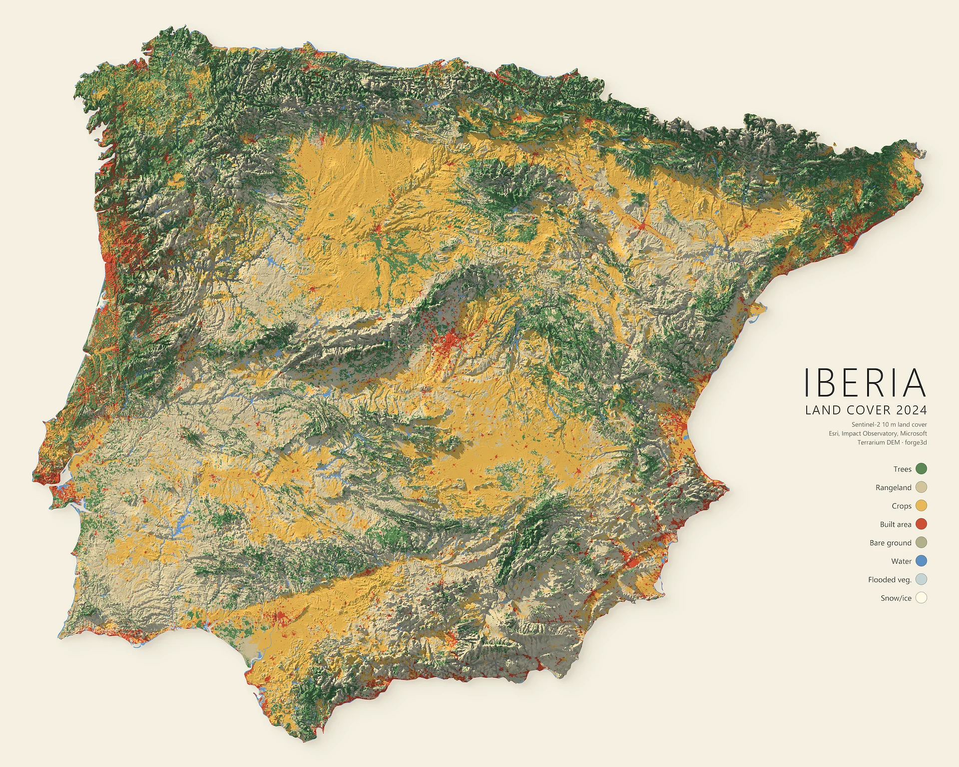
Every forest, field, city and river on this poster is real. The land cover is drawn from Sentinel-2 satellite imagery at 10-metre resolution (Esri · Impact Observatory · Microsoft, 2024) and draped over the peninsula's true elevation. The terrain is then lit by a physically-based path tracer — the same lighting math used in film — so the Pyrenees, the central Meseta and the Sierra Nevada cast genuine soft shadows across 582,000 km² of Spain, Portugal, Andorra and Gibraltar.
The result reads as data and as art at the same time: the golden crop belts of the interior, the dense green Atlantic north, and the red pinpricks of every major city.
Eight land-cover classes, measured to the pixel
- Rangeland — 43.1%
- Crops — 26.0%
- Trees — 24.5%
- Built area — 5.2%
- Water — 1.0%
- Bare ground · Flooded vegetation · Snow/ice — the remaining fraction
What you get
- One high-resolution PNG, 9000 × 7200 px (5:4), with an embedded sRGB colour profile
- Print-ready at 450 PPI → 20 × 16 in, and stays crisp up to 30 × 24 in (76 × 61 cm) at 300 PPI
- Fits standard 16×20 / 24×30 frames — print at home or at any photo lab
- Instant download — no shipping, no waiting
Rendered with forge3d. Land cover: Sentinel-2 10 m Land Use/Land Cover (Esri, Impact Observatory, Microsoft, 2024). Elevation: Terrarium DEM.